Vjosa River: Albania's Wild River National Park Guide
Plan a visit to Albania's Vjosa River, Europe's first wild river national park: where it runs, the towns along it, rafting, canyons and how to get there.
On this page
The Vjosa is a free-flowing river running about 272 km from the Pindus mountains in Greece to the Adriatic north-west of Vlorë, and Albania declared it Europe's first wild river national park in March 2023. This guide covers where the river runs, which towns make the best base, the landscapes worth seeking out and how to reach the valley by road.
Treat the river and the park as two separate things when you plan. The water is a long geographical feature with towns strung along it, while the protected area is a defined boundary with rules attached, and knowing which you are heading for shapes everything from your base to your driving.
Where the Vjosa runs, from Greece to the Adriatic
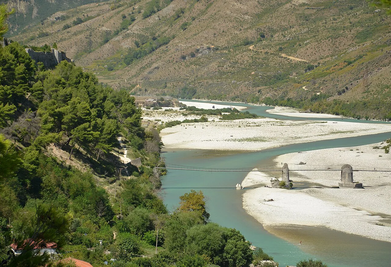
The Vjosa rises in Greece's Pindus mountains and crosses into Albania near Çarshovë, then flows north-west past Përmet, Këlcyrë, Tepelenë, Memaliaj, Selenicë and Novoselë before reaching the Adriatic north-west of Vlorë. Of its roughly 272 km, about 80 km lie in Greece and the remaining 192 km in Albania.
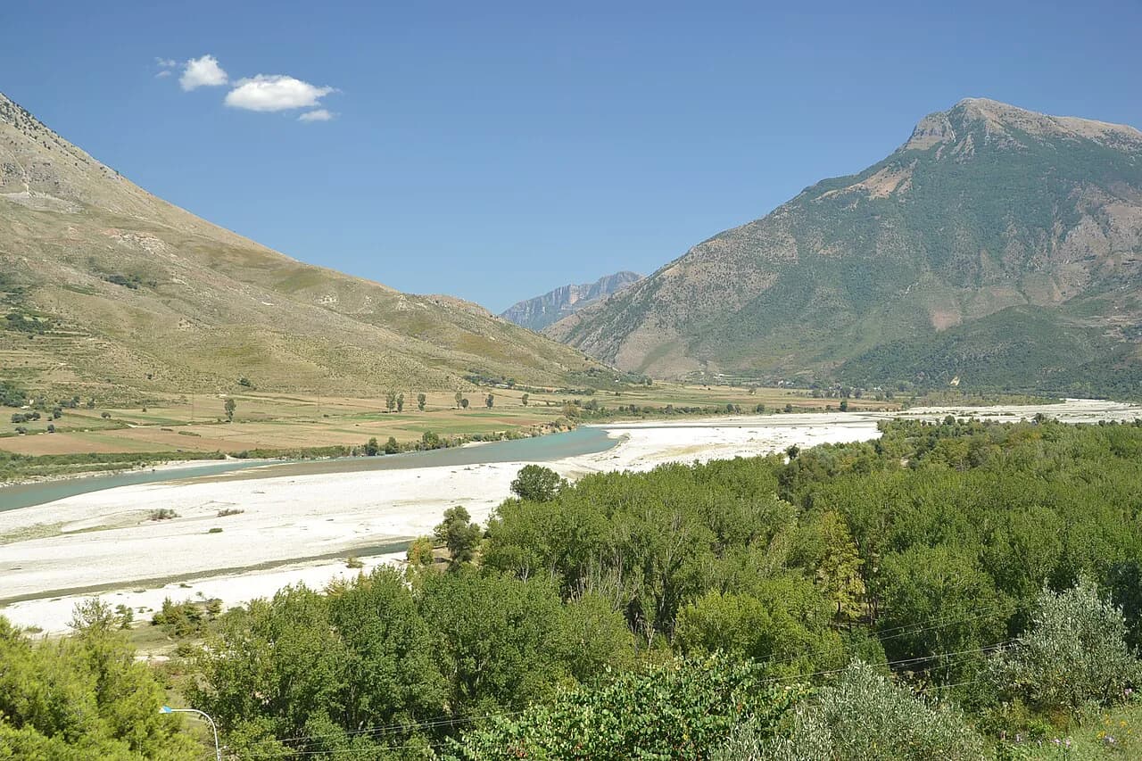
The character changes as it goes. The upper section runs through narrow gorges, the middle course opens into wide gravel plains and sandbanks split by branching arms, and the lowest stretch ends in a largely natural delta on the coast. Plan around the section that matches what you want to see rather than trying to cover the whole river.
The river is also known by its Greek name, Aoös, which is useful when you read maps or signs produced on the Greek side of the border, where the first stretch of the catchment sits.
What Vjosa Wild River National Park protects
The park was announced on 15 March 2023 at a ceremony at Tepelenë castle, covering 12,727 hectares and given IUCN category II status, a level of protection that, as the Guardian reported, bans dams and gravel extraction. The Guardian reported that the park was expected to be operational in 2024, and the park's own site describes the first phase as operational by early 2024.
The park's published figures give a sense of scale: more than 400 km of waterway in the river system, more than 1,000 animal and plant species and around 300 cultural monuments within its geography, including a UNESCO Cultural World Heritage site. Its biodiversity includes 13 animal species and two plant species assessed as globally threatened by IUCN.
Before the park was declared, the Lengarica, Shtika and Çarshova valleys were already affected by dams, which is why they were left out of the park proposal at the time; the main river and its three main tributaries were the focus of the 2023 declaration, so do not assume the whole catchment is equally protected.
If you are working through the country's protected areas, our guide to Albania's National Parks sets the Vjosa alongside the others; lakes further north, including Lake Shkodra, are covered separately in our piece on lakes in Albania.
The towns along the river: where to base yourself
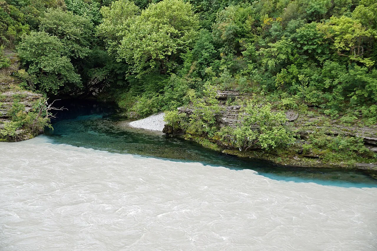
Përmet is the most useful base for the southern, upper stretch, sitting in a secluded area around a small town with cultural monuments, high mountain peaks and a national park nearby. From here you can reach the Katiu Bridge, the Bënja thermal baths and the Lengarica side valley without a long drive.
Këlcyrë sits where the river passes through a deep gorge east of Tepelenë, and Tepelenë itself is the point where the Drino arrives from Gjirokastër, making it a natural stop between the two towns. Memaliaj, Selenicë and Novoselë follow downstream towards the coastal plain, but they are working towns rather than visitor centres, so treat them as landmarks on the drive.
Vlorë is the nearest coastal city to the river's mouth, and Gjirokastër is the most convenient larger town for the upper valley coming from the south. Both make practical overnight stops if you want an early start on the water.
The gorge, the braided middle and the delta
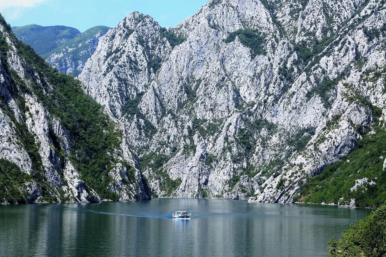
Three landscapes deserve separate days if you have them. The Këlcyra gorge east of Tepelenë is the tightest scenery, with the river cut into a valley partly surrounded by high mountains; the braided middle course is where the water splits into branching arms between pale gravel banks and sandbanks; and the delta near the coast is the most natural stretch, best seen as a roadside pause rather than a destination in itself.
The middle course is the easiest to appreciate without a boat, because the gravel plains are wide and the riverbed in places is broader than ten football pitches. In the middle course alone there are at least eight habitat types classified as the highest conservation priority in the EU, so even a short stop is worth more than a photo from the bridge.
Rafting, kayaking and canoeing on the Vjosa
Rafting, canoeing, kayaking and swimming have become established on the Vjosa and its tributaries in recent years as ecotourism has grown in the valley. The park's own site invites visitors to raft in its meandering waters, hike and camp in its forests, and climb and swim in its canyons.
Operator rates and departure times are not set out in the sources here, so arrange any trip locally in Përmet or Tepelenë and confirm the meeting point, river section and kit before you commit. If paddling is the main point of your trip, our Albania rafting and Albania kayaking pages cover the options more broadly.
Swimming, hiking and camping by the river
Swimming, hiking and camping are all described as activities the park supports, with forests along the waterway and canyons that invite a climb and a dip. Water quality samples from the Vjosa show generally good results, though higher values were found for iron and hardness, so treat the river as a wild waterway and use your own judgement.
Wildlife is part of the appeal: otters, the threatened Egyptian vulture and a wide range of aquatic species live in and around the river. Our Albania wildlife guide covers where else to look for the country's fauna, while Albania mountains and Albania caves are useful if you want to add upland and underground stops to a river trip.
Bënja thermal baths, the Katiu Bridge and the Lengarica valley
Near Përmet, three stops combine well into a half-day loop: the Katiu Bridge, the Bënja thermal baths and the Lengarica side valley. The Lengarica was one of the tributaries already affected by dams and left out of the original park proposal, so the protection status you read about for the main river does not automatically extend here.
The Katiu Bridge is a short stop on the road near Përmet and the easiest of the three to visit. If waterfalls are on your list for the wider trip, our Albania waterfalls page covers the ones that fit a southern Albania route.
The Shushica tributary and the Brataj Bridge
The Shushica is the Vjosa's other main tributary, draining a catchment of around 715 square kilometres and crossing the Brataj Bridge on its way to join the main river. Its karst geology supplies underground water during the dry season, which keeps the flow up when the surface channels thin out.
Getting to the Vjosa valley by road
From the south, come up from Gjirokastër via the Drino valley to Tepelenë, which puts you at the gorge and the middle river in one approach. From the coast, Vlorë is the starting point for the lower river and the delta, with the road running inland through Selenicë and Memaliaj towards Tepelenë.
For the upper valley and Përmet, the usual approach is from Gjirokastër through the mountains past Çarshovë, a winding drive on valley roads rather than a fast trunk route. Allow generous time, fill up before you leave the larger towns and avoid planning a tight schedule around a long mountain transfer.
How long the Vjosa and Përmet need
Two nights in Përmet gives you one full day for the Katiu Bridge, Bënja and the Lengarica valley, plus a second for a rafting or kayaking session and a slow drive to the gorge. A single night is enough if you only want the river views and one activity, but it leaves no slack for weather.
Split a longer visit between the upper and middle river: base in Përmet for the southern section, then move to Tepelenë or Këlcyrë for the gorge and the wider braided stretches. Trying to cover the delta on the same day means a long drive to the coast, so treat it as a separate stop when you head for Vlorë.
When to go: the river and roads across the seasons
The Vjosa's karst catchment supplies abundant underground water during the dry season, which keeps the river running when smaller streams shrink. That makes the warmer months the practical window for paddling and swimming, though the gravel banks and exposed valley floor get very hot in the middle of the day.
Valley roads and gravel tracks are the variable worth planning around. Build in a spare day for a mountain transfer, start driving early and keep your itinerary loose if you are crossing the passes between Gjirokastër and Përmet.
Nearby: ancient Byllis above the river
Downstream in Mallakastra, the ancient town of Byllis sits high above the river and is described as one of the most beautiful historical sites in Albania. It is a natural add-on if you are driving between Tepelenë and the coast, and it breaks up a long day on the road.
Practical points: park rules and what is off-limits
National park status under IUCN category II bans dams and gravel extraction, so the riverbed and banks are not a place to take stones, light fires on dry gravel or drive off established tracks. Camping is described as an activity in the park's forests; pitch considerately and pack out everything.
The park was described as expected to be operational in 2024, so facilities such as visitor centres, marked trails and ranger posts may still be developing. Check locally in Përmet or Tepelenë for the current situation before relying on any facility.
Where the Vjosa fits into a southern Albania itinerary
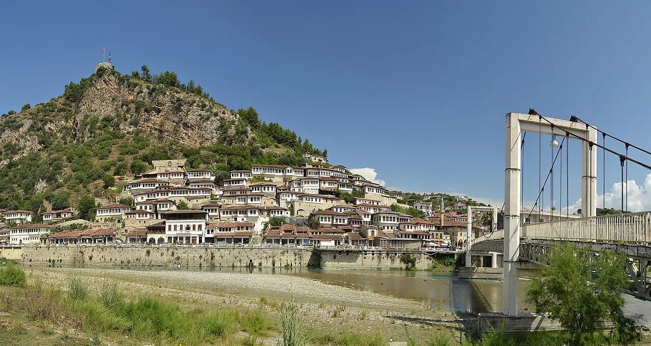
The Vjosa works best as a two- to three-day leg linking Gjirokastër, Përmet and Berat. Come south to north: Gjirokastër for the old town, Përmet for the river and thermal baths, Tepelenë for the gorge, then on towards Berat or the coast at Vlorë.
If you are travelling with a car, the river is an easy add-on to a wider national parks circuit; without one, base in Përmet and arrange local transport for the day trips. Either way, keep a buffer day for weather and road conditions, because the valley roads are slower than the map suggests.
Which stretch of the Vjosa should you plan around?
Choose Përmet if you want the thermal baths, the Katiu Bridge and the easiest access to rafting and kayaking on the upper river. Choose Tepelenë or Këlcyrë if the gorge and the wide braided stretches are your priority, and accept a slower drive to get there.
Whichever you pick, build in a spare day, plan your fuel and food stops around the larger towns, and confirm locally that the section you want is accessible before setting out. The Vjosa rewards a loose itinerary more than a tightly booked one.
Sources
Notes for your Albania trip
Optional updates to our Albania town guides.
You might also like
Continue reading
More guides you'll find useful