Vlorë Map: Old Town, Castle and Waterfront Layout
A visitor's map guide to Vlorë, showing how the old town, castle hill and waterfront fit together and how to read the street layout before you arrive.
On this page
A Vlorë map is best used as an orientation tool rather than a list of pins: it shows a coastal city and municipality in southern Albania with a deep-sea port, and the second largest port city in the country after Durrës. Once you can see how the port and waterfront, the old town and the hill above relate to one another, planning a day on foot becomes much simpler. This guide covers what a map of the city shows, how to use a tourist map alongside a satellite view, and where Vlorë sits on a map of Albania.
Nothing here depends on live opening hours, ticket prices or boat timetables, which a general map site cannot give you in any case. For those, check the venue directly before you set out, and use the map to work out the shape of the city first. Our Things to Do in Vlorë guide covers the sights themselves once you know where they sit.
What a Vlorë map shows you
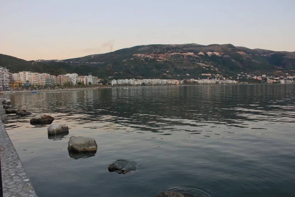
At city level, Vlorë reads as a coastal settlement in southern Albania whose street pattern is tied to a deep-sea port. The city is also the second largest port city in Albania after Durrës, which explains why the harbour side carries weight on any map you open. Look for the port and the waterfront first, then the denser urban fabric behind it.
The city is also known for its significance in the country's independence, so expect monuments and civic buildings to appear as landmarks on detailed maps rather than as anonymous blocks. Treat those labels as orientation markers, not as a sightseeing list.
The main shapes: port, waterfront and the hill above
Three shapes do most of the work when you orient yourself: the port and waterfront strip, the older urban core behind it, and the higher ground that rises above the city. On a printed or on-screen map, the waterfront is usually the easiest line to follow because it curves with the coast. Use it as your baseline and read everything else as a direction from it.
The old core is where the street pattern changes character, so it is worth zooming in on that area before you travel. A dedicated page on Vlorë Old Town sets out what sits within those blocks and how to walk them. That level of detail belongs in a place guide rather than on a general map.
Above the core, the higher ground gives you a second reference point: whichever way the slope runs tells you where you are relative to the waterfront. Maps that show contour lines or shaded relief make this obvious, while plain street maps often flatten it out. If your map has no relief, switch to a satellite or terrain layer for a moment.
How the old core relates to the waterfront on foot
Walking in a coastal city is mostly a matter of choosing a direction and holding it: from the waterfront you either follow the shore or turn inland and uphill. Check the street names on your map before you set off so you can recognise the point where you turn. That single decision saves the circling that happens when a grid of small streets looks identical in every direction.
If you would rather follow a fixed route than improvise, a Vlore walking tour does the sequencing for you. Otherwise, plan a loop that starts at the water, works inland through the older streets and returns along a different line. Either way, carry the map offline so a lost signal does not strand you.
Build in slack for the heat and for the slope, both of which slow a short distance on paper. A route that looks tight on a map can take noticeably longer in the middle of the day.
Where the street network gets tangled
Older cores tend to have short blocks, changing street names and lanes that do not run through, which is where visitors most often go wrong. The fix is simple: pin two or three fixed points on your offline map, such as the waterfront and the edge of the old core, and navigate between them rather than trying to memorise every turn.
Download the map area before you arrive so it works without mobile data. A screenshot of the city centre at a sensible zoom is a useful backup when an app is slow to load.
Tourist map versus satellite view
A tourist map is better at naming things: streets, squares and civic landmarks are labelled and generalised so the city reads clearly at a glance. A satellite view is better at showing what is actually there, including the density of buildings, the width of the waterfront and the lie of the land.
Use both: the labelled map to plan, the satellite layer to check that the plan matches reality. High-contrast, stylised urban maps of Vlorë also exist, showing the street network and coastal geography, which are handy for seeing the whole pattern at once.
Reading Vlorë on a map of Albania
Zoom out and you can place Vlorë within Vlorë County, whose boundaries, main cities and names are mapped separately from the city street grid. Switching between a county map and a city map shows how the urban area sits within the wider territory.
County-level maps, including blank and outline versions, are useful for seeing how the city relates to the surrounding area without street-level clutter. Keep one county map and one city map rather than trying to do both jobs at once.
Map features to check before you travel
Check the scale before you trust a walking estimate, because a small-scale map can make a long waterfront stroll look like a few minutes. Then check the spelling: the city appears as Vlorë and as Vlora on different maps, and both refer to the same place. Search for the form your map uses, but expect the other to appear.
Watch the diacritics on Albanian place names, since a missing ë can break a search or send you to the wrong street. If an app fails to find a name, try the version without accents.
What a general map will not tell you is opening hours, ticket prices or boat departure times. Plan to confirm those with the venue or operator directly, and treat the map as the layout only. A separate page on Vlore boat trip options and a list of Vlore museum opening details are the places to look for the time-sensitive parts.
Which map to open first
Open the labelled city map first to learn the three shapes: port and waterfront, old core, and the hill above. Then switch to satellite or terrain for a minute to check the slope and the density, and save both offline before you travel.
Everything time-sensitive, from hours to boat departures, needs checking before you set out rather than reading off a map. Use the layout to plan your route and current timetables for your day, and read up on Vlore history separately if you want the stories behind the labels.
Explore more Vlore guides
Frequently Asked Questions
Is Vlora the same as Vlorë?
Yes. Both spellings appear on maps and in listings for the same coastal city in southern Albania, and you will also see the definite form Vlora in Albanian usage. If a search returns nothing for one version, try the other.
Can I use a Vlorë map offline?
Yes, and it is worth doing. Download the city area in your mapping app before you arrive, or save a screenshot of the centre at a useful zoom, so the layout is available without mobile data.
Does a city map show bus stops and boat landings?
Detailed mapping apps usually mark transport stops, but coverage varies and times are not reliable from a map alone. Check services and departure points at the local bus station.
Sources
Notes for your Albania trip
Optional updates to our Albania town guides.
You might also like
Continue reading
More guides you'll find useful