Butrint National Park: What to See and How Long You Need
Plan a visit to Butrint National Park in southern Albania: the Greek and Roman remains worth your time, the wetland wildlife around them, and how long to allow.
On this page
Budget two to three hours for Butrint's archaeological core and treat the wider park as a separate, slower outing. The ticketed site sits on a peninsula wrapped by Lake Butrint and the Vivari Channel, roughly 18 km south of Sarandë, so it works as a half-day from the coast rather than a quick stop. This guide covers what stands inside the walls, the wildlife in the surrounding wetlands, how to get there and how to split your time.
What Butrint National Park actually is
Butrint is two things at once: an archaeological site on a small peninsula and a national park of 9,424 hectares of hilly terrain, freshwater lakes, wetlands, salt marshes, open plains, reed beds and islands. The park's brief covers the lake and lagoon of Butrint, the natural channel of Vivari, the islands of Ksamil and the excavated city. Knowing which part you are visiting shapes your day, because the ruins take hours while the wetlands take a car, binoculars and patience.
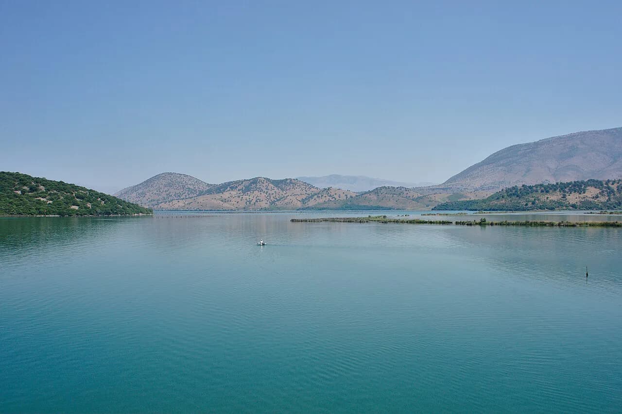
The site occupies a peninsula between Lake Butrint and the Vivari Channel, which links the lake to the Ionian Sea through a narrow sandy bar. That geography explains the feel of the place: water on both sides, a mild Mediterranean climate with hot, dry summers, and a walk that keeps opening onto views rather than following a single street. The ancient city appears in the sources as Buthrotum in Latin and Bouthroton in Greek, and the modern Albanian name is Butrint.
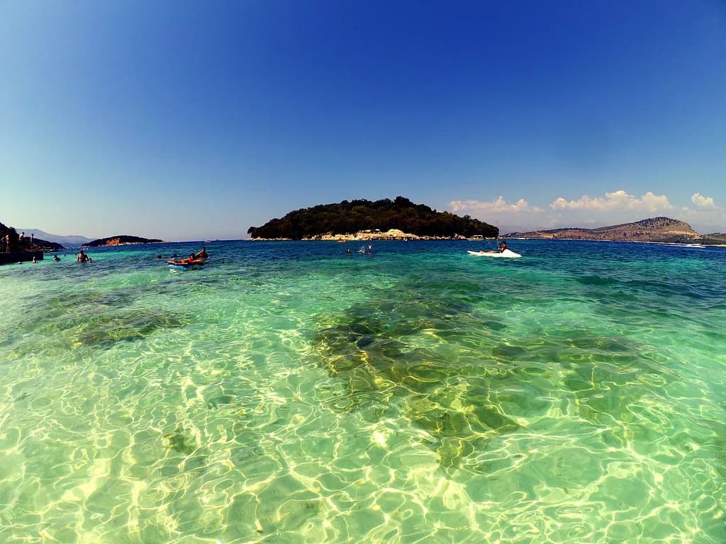
The nearest town is Sarandë, about 18 km away, with the park lying in Vlorë County in the far south of the country near the Strait of Corfu. Ksamil sits on the same coast and shares the park's islands, so the two are naturally paired in a day out; our guide to things to do in Ksamil covers the beach side of that pairing. Villages and towns around the site are covered elsewhere on this site; here the focus stays on the park itself.
What to see inside the archaeological site
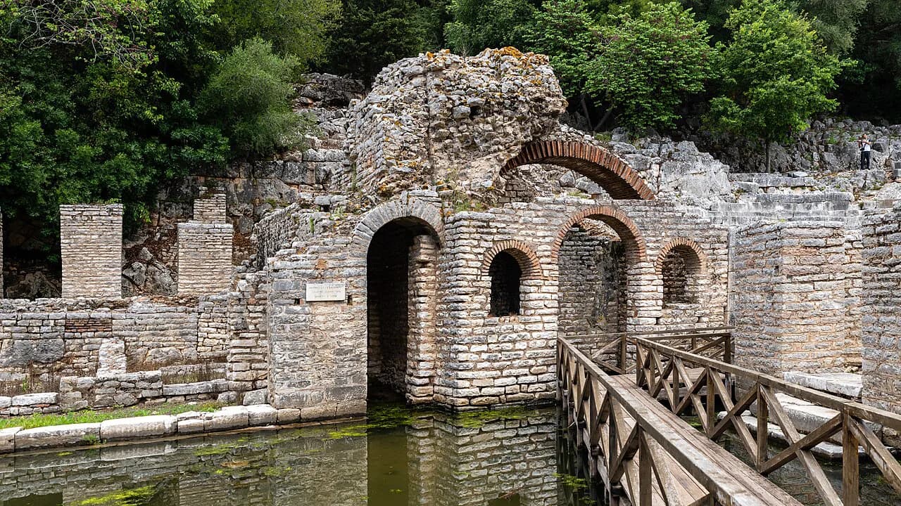
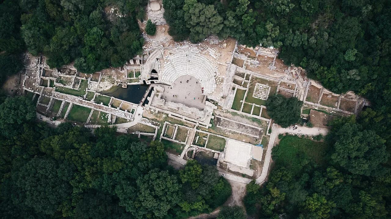
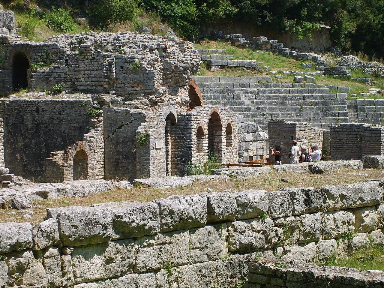
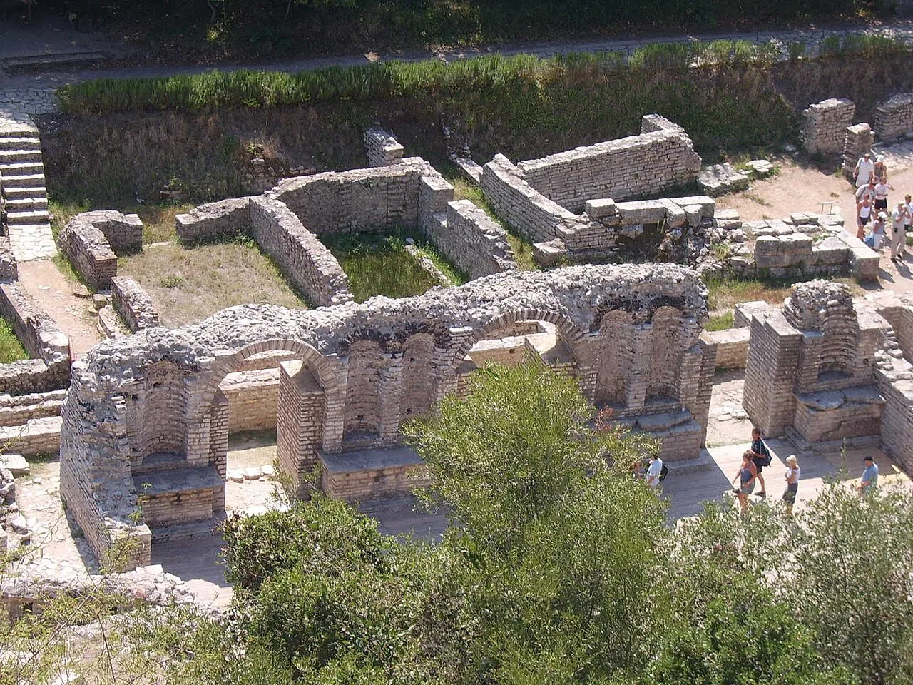
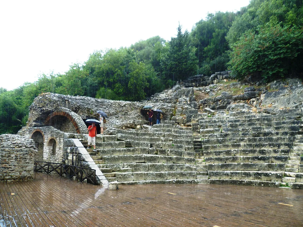
Start with the theatre, cut into the slope at the foot of the acropolis with two temples close by, one dedicated to Asklepios, the Greek god of medicine. Seeing the seating, the stage area and the temple platforms together makes the layout of the ancient city click. Climb a little above the theatre for the plainest view over the peninsula and the water on either side.
The Baptistery holds a mosaic pavement dated to the early sixth century, and it is the single detail most visitors remember. Take it in while you are on the low ground with the theatre rather than saving it for the climb to the acropolis, because the floor is easy to hurry past. The Nymphaeum and the Triconch Palace, a Roman villa complex opened for public viewing in 2005, round out the main circuit.
Roman building at Butrint included an aqueduct feeding fountains, bath houses, a forum, a gymnasium and further theatres, alongside villas and palaces, which is why the site reads as a city rather than a cluster of monuments. Expect to walk between distinct clusters of masonry rather than along one processional route. The paths cross ground that has been excavated, rebuilt and excavated again, so a map is worth having open on your phone.
The layers you walk through
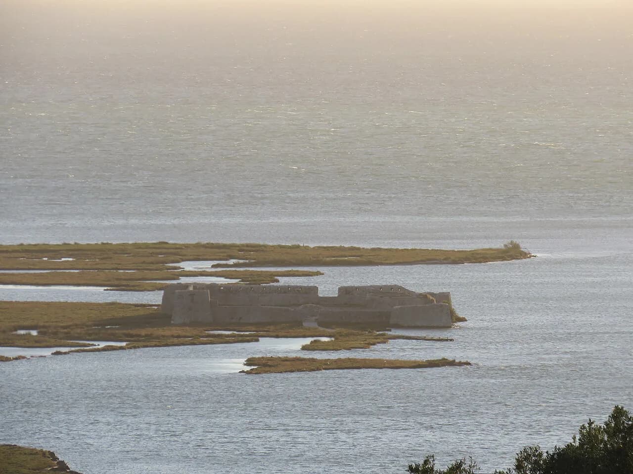
In a small area you pass Greek, Roman, Byzantine, Venetian and Ottoman remains. Christianity took hold by the fifth century, when basilicas went up, some inside earlier structures; the Venetians bought the area from the Angevin kings in 1386 and held it, with Corfu across the straits, until their empire fell in the late 1700s. The medieval city was then largely abandoned as marshland spread across its territory, leaving a small fishing village around a Venetian fortress on the southern bank of the channel.
That long occupation is why the site can feel confusing: buildings were adapted rather than replaced, and later centuries reused earlier walls. Read a little before you go, or take a guided visit, and the sequence from Greek colony to Roman city to bishopric to Venetian outpost becomes legible in the stones. The fortress on the channel bank is a natural first or last stop on the circuit.
The natural side of the park
The park's conservation value rests on its variety of habitats packed into a small area: freshwater lakes, wetlands, salt marshes, open plains, reed beds and islands, supporting more than 1,200 different animals and plants. This is not scenery you tick off from a viewpoint; most of it sits beyond the ruins, along the lake and the channel. Bring binoculars if you have them, and give the water's edge a slow ten minutes.
Birds are the headline: around 250 species have been recorded, both water birds and smaller woodland species, with white stork, glossy ibis, Caspian tern, cattle egret, golden oriole, black-headed bunting and olive-tree warbler among those worth watching for. Reptiles are unusually well represented for the size of the area, including European pond terrapin, neck-striped terrapin and the marginated tortoise, plus Balkan wall lizard, Erhard's wall lizard and European glass lizard. Snakes recorded include sand boa, leopard snake and four-lined snake.
Mammals are harder to see but present, with European otter and golden jackal noted for the area, along with the rare Greek water frog among the amphibians. Treat all of this as wild viewing: stay on paths, keep your distance and do not feed anything. A morning start gives you cooler air and better odds of activity around the water before the day heats up.
How to get to Butrint
Butrint is reached by road from Sarandë, following the route south along the coast and then onto the peninsula. A road from Sarandë to the archaeological site was built in 1960, during the communist period when the area was a militarised buffer zone separating Sarandë from northern Greece. Plan your own transport or join an organised visit rather than relying on a scheduled service.
Driving yourself gives you the most flexibility, especially if you want to combine the ruins with the lagoon and wetland edges where the birdlife is. The trade-off is parking and the return drive after a hot morning on your feet. If you are staying in Ksamil, the site is close enough to visit before the beach crowd builds, and the two fit comfortably into one day. For the coastal half of that plan, see our guide to things to do in Ksamil.
Guided visits suit anyone who wants the sequence of Greek, Roman and later phases explained on the spot rather than read up beforehand, and they remove the transport problem. Check what a tour includes before booking, because some cover the archaeological site only while others add the channel and the fortress. Published prices and departure times vary by operator and season, so confirm them directly when you book.
How long Butrint needs
Two to three hours covers the archaeological core at an unhurried pace: theatre and temples, Baptistery, Nymphaeum, Triconch Palace and the fortress. Add an hour if you want to sit with the birdlife along the channel or walk a stretch of the wetland edge. Anyone hoping to see the wider park's lakes, marshes and islands needs a half-day at least, and a car.
The peninsula layout means you walk in, loop through the ruins and walk back out, with the acropolis slope adding the only real climb. Surfaces are uneven masonry, earth and gravel rather than paving, so sturdy shoes matter more than distance. In summer, the heat is the limiting factor rather than the size of the site; start early and carry water.
Getting around the site on foot
Plan the visit as a circuit: enter, take in the low ground with the Baptistery and the theatre, climb the acropolis slope for the view, then finish at the channel-side fortress before leaving. The slope is short but uneven, and the ground underfoot alternates between excavated stone, grass and gravel. Allow extra time if anyone in your group is unsteady on their feet, and skip the climb rather than rush it in heat.
Shade is patchy across the open ground, so a hat and water are not optional in summer. The green peninsula setting makes the walk pleasant, but it also means mosquitoes near the water in the warm months. There are no shortcuts between the far clusters, so decide what you most want to see and accept that you will not see everything at speed.
Tickets and opening hours
Ticket prices and opening hours at Butrint are not quoted here, because they change and vary by season; no authoritative published figures are available in the sources used for this guide. Check the official Albanian national parks or culture ministry channels before you travel. Allow a few minutes at the entrance in high summer.
Do not budget on the strength of an old blog post or a tour operator's listing, since neither is authoritative for gate prices. The same applies to boat trips along the Vivari Channel and to any combined ticket offer: ask at the park entrance what is currently included. If a price is quoted in euros rather than lek, check the conversion before you pay. Prices and inclusions can change, so confirm current details with Butrint National Park before relying on them.
Butrint with Ksamil and the coast
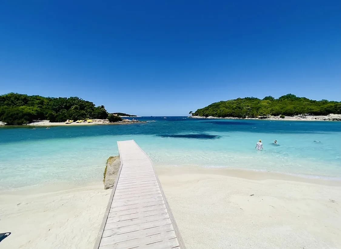
Butrint fits neatly into a southern Albania day that starts at the ruins, moves to the channel for a slow lunch, and ends at the coast. The park's remit includes the islands of Ksamil, so the beach and the archaeology share the same landscape even though they make different demands on your time. Keep the ruins for the morning and the water for the afternoon, and if the beach is the main draw, plan it alongside our guide to things to do in Ksamil.
For history with a different flavour, Ali Pasha's castle at Butrint stands near the channel and pairs naturally with the ancient city on the same outing. Where exactly to stop along the water, and which crossing or boat point suits your route, is worth settling with a map before you set off; the Butrint map lays out the peninsula, channel and nearby stops. Organised options are covered in our guide to Butrint Tours.
What the park protects
The park's mandate is protection as much as presentation. It covers the lake and lagoon of Butrint, the natural channel of Vivari, the islands of Ksamil and the archaeological site, and its conservation importance rests on the number of species recorded within a small area. That combination of wetland, open water and excavated ground is unusual, and it is why the site reads as landscape rather than a walled museum.
Staying on marked paths protects both the masonry and the reed beds, and keeps you from disturbing birds nesting near the water. In the wettest months the channel and marshes carry more water and the edges soften; in high summer the ground dries out and the heat rises. Either way, the archaeological core stays walkable.
Practical points for a hot day
Carry at least a litre of water per person, wear shoes with grip, and take sun protection; the site's open ground offers little shade. Binoculars are worth the weight if you want the birds, and a small torch helps in covered or lower areas of the ruins. Keep bags light, because you will be walking on uneven ground for a couple of hours.
Summer on this coast is hot and dry, with mild winters, so an early start is the single most useful decision you can make. Groups with young children or older walkers should plan a shorter loop centred on the theatre and Baptistery and leave the acropolis climb optional. Photography is best in the softer light of morning or late afternoon, when the stonework stops glaring.
Which Butrint visit to plan
If you have half a day, take the archaeological circuit at an easy pace and stop for the channel view on the way out. If you have a full day, add the wetland edges for birds and reptiles, and pair the ruins with Ksamil or Ali Pasha's castle nearby; our Butrint Tours guide covers guided options if you would rather not drive. Either way, go early, carry water and leave the tickets to be confirmed at the gate.
Explore more Ksamil guides
Frequently Asked Questions
Is Butrint National Park the same as the Butrint archaeological site?
The national park is much larger than the ruins. It covers 9,424 hectares of hills, lakes, wetlands, salt marshes, reed beds and islands, and its remit includes Lake Butrint, the Vivari Channel, the islands of Ksamil and the excavated city. The archaeological site on the peninsula is the part you walk through on a ticket, and it is where you find the theatre, Baptistery, Nymphaeum and Triconch Palace.
Why was Butrint abandoned in the Middle Ages?
The city was largely abandoned at the end of the Middle Ages when marshland spread across its territory. It had already passed through Slav, Byzantine and Angevin rule and a short Venetian occupation. By the early nineteenth century only a small fishing village remained, clustered around the Venetian fortress on the southern bank of the Vivari Channel.
Can you visit Butrint without a car?
Organised visits from Sarandë and the surrounding coast are the simplest car-free option, and guided tours also explain the sequence of Greek, Roman and later phases on site. Some tours cover the archaeological site only, while others add the channel and the fortress, so ask about pickup points and return times when you book.
What should you wear to Butrint?
Wear shoes with grip for uneven masonry, earth and gravel, and add a hat and sun protection because shade across the open ground is patchy. Take water for a two- to three-hour walk, and binoculars if you plan to watch birds along the channel. There is no dress code, but cooler months and mornings near the water call for a light layer.
Sources
Notes for your Albania trip
Optional updates to our Albania town guides.
You might also like
Continue reading
More guides you'll find useful