Butrint Lagoon: Lake Butrint, the Vivari Channel and the Ruins
The Butrint lagoon sits beside the ancient city in Butrint National Park, with the Vivari Channel linking Lake Butrint to the Ionian Sea. Here is how to visit.
On this page
Butrint lagoon is the water that surrounds the ancient city inside Butrint National Park, not a separate sight. Lake Butrint lies around the peninsula, the lagoon is the wetland water at the lake edge, and the Vivari Channel takes the water from the lake out to the Ionian Sea through a narrow sandy bar, so you meet the whole system on the same walk as the ruins. This page sketches the water, then covers how to reach it, what the circuit passes and how long to allow.
The park covers 9,424 hectares of hilly terrain with freshwater lakes, wetlands, salt marshes, reed beds and islands, and its mandate includes protecting the lake and lagoon of Butrint together with the Vivari Channel and the islands of Ksamil. That is why the archaeology and the wetland feel like one place as you walk the path: you are moving between fallen stone and standing water, not between a museum and a nature reserve. Plan the layout with the Butrint National Park guide and the Butrint map.
Which water is which: Lake Butrint, the lagoon and the Vivari Channel
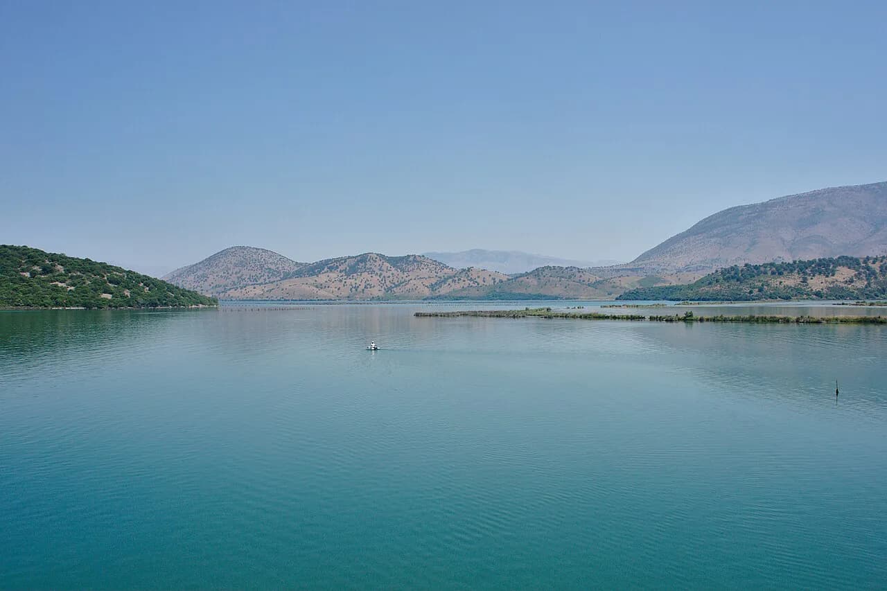
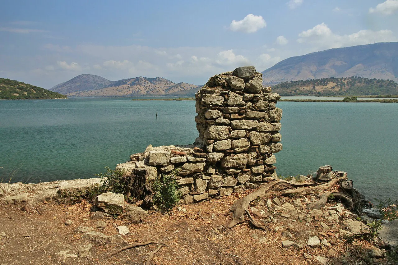
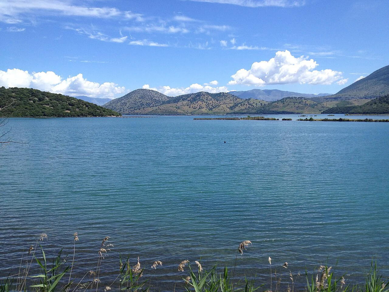
Lake Butrint is the freshwater body on the landward side of the ancient city, and the park also protects the lagoon at its edge, with reed beds, salt marsh and shallow water marking the transition. The lake and lagoon are usually spoken of together because the shoreline blurs between them. Look for the reeds and the yellow-green shallows where the open water meets the path.
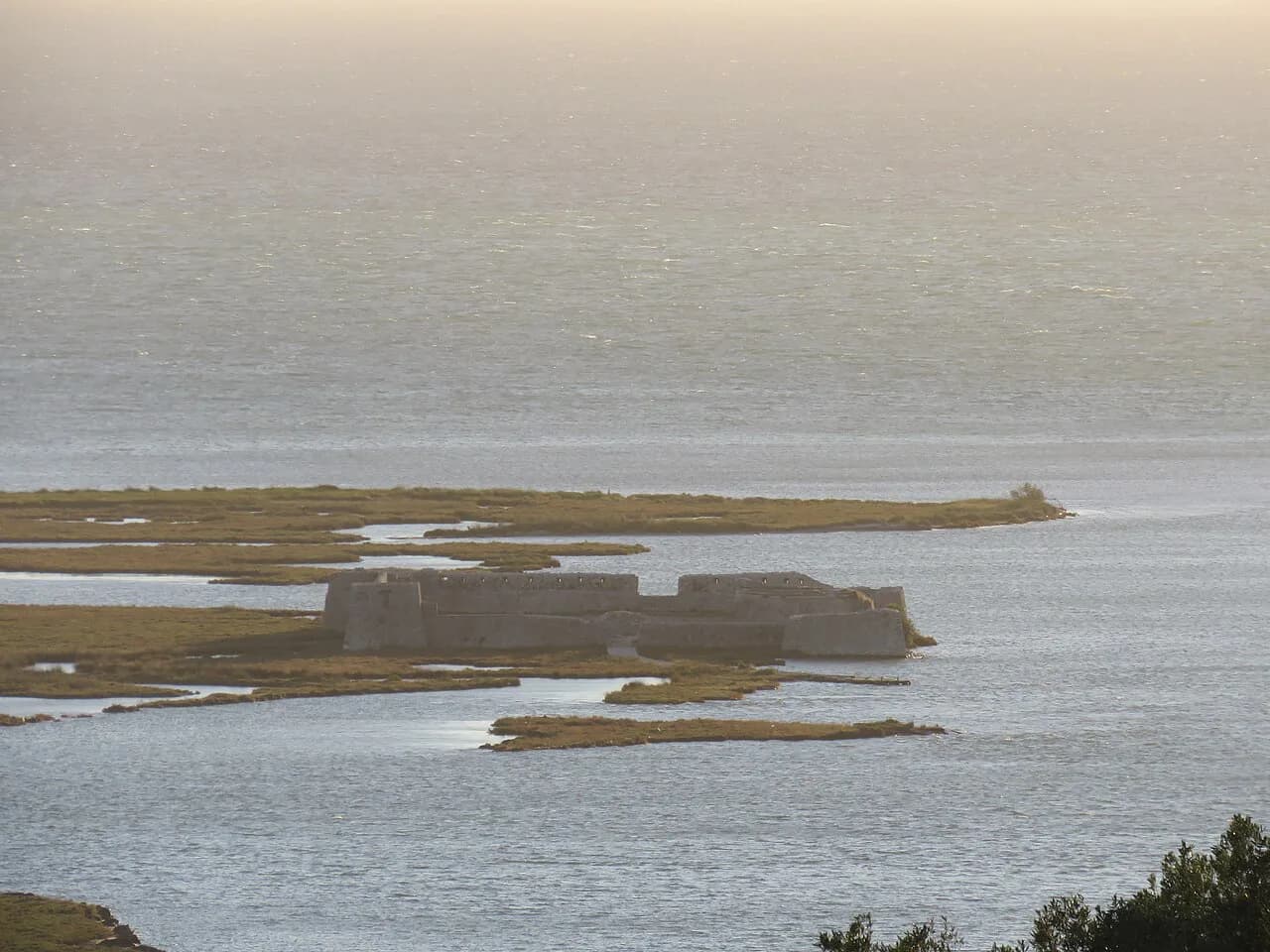
The Vivari Channel is the outlet: it connects the lake to the Ionian Sea through a narrow sandy bar. It is working water rather than a backdrop — overflow parking sits on the far bank and a car ferry shuttles vehicles across the channel. It is also the line you look down on from the acropolis, and Ali Pasha Castle stands across the water if you want to add it to the day.
Orientation is simple once you have the shape in your head. The ancient city sprawls across a peninsula surrounded by Lake Butrint and the Vivari Channel, and the park sits in the extreme south of Albania by the Strait of Corfu, with the Greek island of Corfu lying to the west across a narrow strait. Stand on the shore path and the lake is behind you, the channel ahead, and the sea somewhere past it.
Where the ruins sit in the park
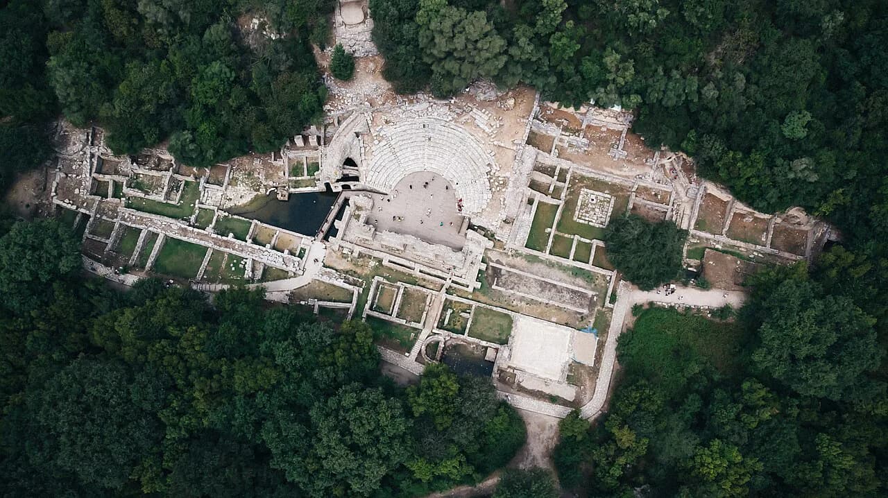
The archaeological site occupies the tip of the peninsula, about 5 km from Ksamil and 18 km from Sarandë along the SH81 coastal road. The park is much larger than the ruins, stretching across Vlorë County, but almost everything you have come to see sits within a short walk of the water.
Because the city sits on a peninsula, the shore path doubles as a circuit. You can follow the walls along the water, duck through the gates and climb to the acropolis without retracing much ground. There is a map at the entrance marking the structures and the route, and the Butrint map shows how the gates, lake shore and castle sit against each other, which saves guesswork on a site where trees grow through the stones.
Getting there: furgons, taxis and the channel ferry
Furgon minibuses run from the centre of Ksamil to Butrint, leaving from the main road junction by the small bus stop on the eastern side of the village. A ticket costs around 100 lek, cash only, and the ride takes about 15 minutes. There is no posted timetable, but most minibuses run every 30 to 60 minutes from morning until early evening, with longer gaps outside summer.
From Sarandë the trip is longer but still under an hour by road, and minibuses run regularly. A taxi from Ksamil takes about 10 minutes and typically costs between €6 and €8 one way, so confirm the fare before setting off. From Sarandë a taxi should cost no more than 1,500 lekë each way, with a bus at around 150 lekë running roughly twice an hour and taking about 35 minutes.
Driving gives you the most flexibility, and parking at the site is free, though the lots fill quickly in summer. The overflow is across the Vivari Channel, reached by a car ferry that costs 700 lek. That crossing is part of the day out rather than a nuisance: you queue, cross the channel and walk back into the ruins from the far bank.
Some visitors come from Corfu by hydrofoil to Sarandë and continue by taxi or bus, arriving at the archaeological site by road rather than by water. Organised Butrint tours from Sarandë and Ksamil take the transport and the route out of your hands, which suits anyone without a car in high summer.
Tickets and timing at the gate
Gate times are reported differently, with one visitor guide giving daily opening from 8am until sunset and another giving 9am to 7pm, so confirm them on the day you travel. Both give entry at 1,000 lek for adults and 500 lek for visitors aged 12 to 18, with under-12s free. Bring cash, because cards are not always accepted.
Go early or late. The light is softer, there are fewer people, and the heat is easier to handle, which matters because the circuit has little shade. In summer the middle of the day is the worst of both worlds: strong sun and the fullest car park.
Walking the circuit: gates, walls and the buildings along the water
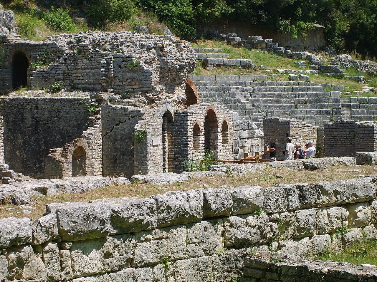
Start low and work upwards. From the theatre, a path leads down past the gymnasium and the Roman villa to the baptistery, then on to the Great Basilica, one of the best-preserved buildings on the site. The baptistery floor carries early Christian mosaics that are covered for protection against seasonal flooding and shown only for short periods every few years, so do not plan the trip around seeing them.
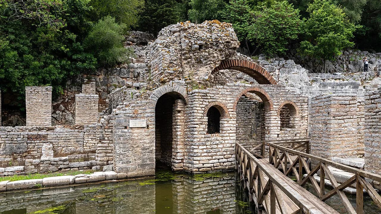
Then follow the path down to the shore and walk the old city walls. The large rectangular blocks are Greek and the brickwork is Roman, and the water opens out beside you. Along this stretch you pass the Tower Gate, the Lake Gate and the Lion Gate, the last carrying a carving of a lion devouring a bull. The gates are narrow on purpose, which is a reminder that this was a defended harbour town rather than a scenic promenade.
The shore of Lake Butrint is the quietest part of the walk, with reed beds and open water where the wetland takes over from the ruins. Much of the site is softened by vegetation, with fig trees and eucalyptus growing through broken stone and footpaths winding between the structures. Keep to the marked trail where the ground is uneven, and note the reeds and shallows where the open water meets the path.
The Venetian castle and the view over the lagoon
The climb to the acropolis is the steepest part of the day and the reward is the outlook. A Venetian castle stands on the hilltop, with parts dating to the 14th century and much of it reconstructed in the 1930s. From the top you look down on the lagoon, the channel and the flat green country beyond.
Inside the castle is a small museum holding statuary and other finds excavated from the city, which gives the walk some context if you have already been through the ruins. A café near the castle opens in summer only, so carry water and something to eat if you are visiting outside that season.
How long to allow
Plan 1.5 to 2 hours for the full circuit, or a little more if you linger at the shore or climb to the castle. That is walking time through the site rather than a whole day, which means Butrint fits comfortably into a morning or an afternoon from Ksamil. If you add the far bank and the channel crossing, allow extra for the ferry queue.
Travellers with a keen interest in the archaeology, or anyone who wants to sit by the water with a picnic, will want nearer three hours. Those treating it as a break from the coast can see the theatre, the baptistery, the basilica and the walls in a tighter window.
Wildlife and scenery around the water
The wetland is the reason the park exists as much as the ruins are. The park supports over 1,200 different animals and plants, and the mix of freshwater lakes, salt marshes, reed beds and open plains gives birds and plant life room to spread out. Birdwatchers should bring binoculars and give the reeds time.
One published count gives the wetlands 800 kinds of plants and 246 bird species, so the open water and reed beds are worth as much attention as the stone. A national-parks.org entry describes a 4-mile (6.4 km) loop through the park, a useful gauge of how much ground the wetland covers.
Practical points for the lagoon walk
Wear decent shoes. The paths are uneven, some of the ground is rough underfoot and the stone is worn smooth where generations of feet have crossed it. Carry water, a hat and sunscreen, because shade is limited across much of the circuit and the Albanian summer is hot.
Summer parking is the main logistical pinch. The free lots by the entrance fill up, and the overflow across the Vivari Channel depends on the car ferry, so arriving early saves a wait. Outside July and August the pressure eases and the site is much quieter.
Deciding between the ruins and the water
Butrint is one visit, not two. The archaeology and the lagoon belong together: the gates open onto the water, the walls run along the shore and the castle looks down on the channel. Give it half a day from Ksamil and the whole thing works on foot.
If you only have an hour, see the theatre, the baptistery and the shore path; if you have longer, add the climb to the castle and the far bank. Either way, check the gate times and bring cash.
Sources
- the Shore of Lake Butrint lagoon in Butrint National Park, Albania Stock Photo - Alamy
- Butrint National Park — Google Arts & Culture
- A Guide to Visiting Butrint National Park, Albania — ALONG DUSTY ROADS
- Discover Butrint National Park in Albania – GoMad Nomad Travel Mag
- Butrint National Park | (Official GANP Page)
Notes for your Albania trip
Optional updates to our Albania town guides.
You might also like
Continue reading
More guides you'll find useful